

Airplane crashes, aerial bombardments and artillery bombardments: the municipality of Altena had to endure a lot during the Second World War. It is therefore not surprising that possible explosives (Explosive Remnants of War) have been left behind in the soil. The historical researchers at Den Ouden Bodac have mapped these out. Colleague Martijn van Bommel explains in this triptych how they tackled this. In this part of the triptych: how do we get our information?
This research used a variety of sources: 'the' data with which a historian works. From (inter)national literature to (inter)national archives and from historical maps to aerial photographs. Too much information to cover here, so an example will be used to explain how different sources were analyzed and processed during this research. It is important to remember: 'One source is not a source', which means that multiple dates must be found in order to be able to claim something about a possible fact that took place in the past. In the case of this research, it concerns acts of war in the territory of the current municipality of Altena: Where did it take place? Who was involved? Which calibers were used?
Source combinations: Resistance intelligence, aerial photographs and Defense Overprint
In the example below, we will zoom in on the village of Nieuwendijk within sub-area 2. The village has been partly declared suspicious on the Risk Map for various types of Explosive Remnants of War (OO), including shot and dumped artillery ammunition. Below it will be explained how this became clear from various sources and how this has been incorporated into our geographic data system ArcGIS Pro.
Tekstuele bron
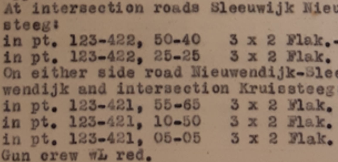
Information from the 'Albrecht Group' was consulted in the National Archives in The Hague for this research. In the final phase of the German occupation, this resistance group directly passed on information to the Allies about German defenses, attack plans, etc. This also applies to the situation in occupied Altena. Here they talk about German anti-aircraft artillery near the village of Uppel in October 1944: 'At intersection roads Sleeuwijk Nieuwendijk and Kruissteeg […] 3 x 2 Flak.-4 barreled […]. This is a first indication that OO may have been left behind at this location. Possibly from the anti-aircraft gun itself, perhaps because the Allies shot at it in response to this information. You can't argue with 'maybe'; deeper research needs to be done.
The figure below is a section from the information documents of the Albrecht Group. Source: National Archives (NA) in The Hague.

Visuele bron: Luchtfoto
The information is confirmed 80 years later by aerial photographs from (approximately) the same period. Exactly at the locations described by the resistance, typical German FLAK positions (Flugzeugabwehrkanone) can be observed on aerial photographs taken two months later. See a zoomed-in section here (source: Wageningen University, WUR). In principle, as a researcher you can no longer ignore it: two reliable sources speak about the same German positions from the ground and from the air. The only thing missing is information about the type of calibers used. This is often not available, as many German archives went up in flames just before the end of the war to protect military secrets. In this specific case it is possible to find it out, via a Defense Overprint from the Library and Archives Canada.
Visuele bron: Defence Overprint
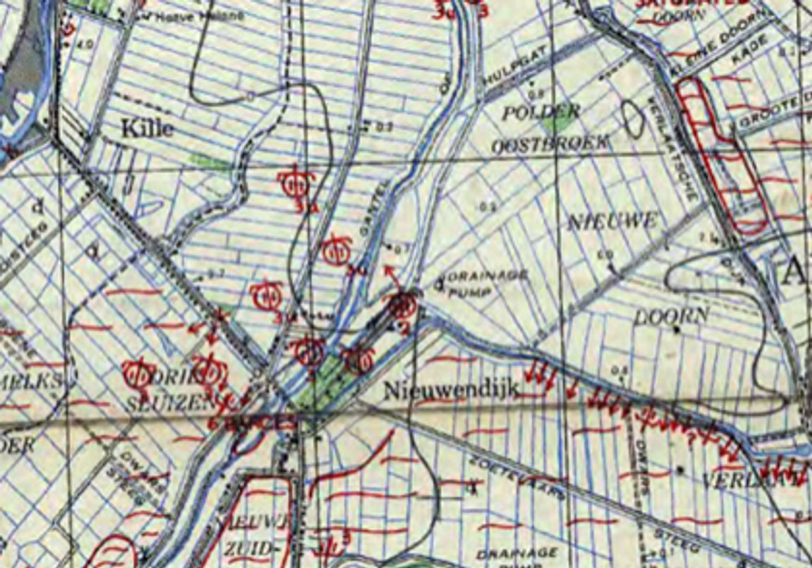
Defense Overprints are Allied military maps that were produced on the basis of (aerial) reconnaissance and intelligence. They were drawn with positions of Allied and German positions, trenches, anti-tank ditches and other military infrastructure. This provided a picture of the enemy positions with regard to gun emplacements, troop strength, military structures and the like. If we place such an Overprint over the positions from the resistance intelligence and the aerial photographs, we see: German anti-aircraft guns. Look at the figure below (source: Library and Archives Canada, LAC): we know from the accompanying legend that the icons drawn in symbolize 2 cm FLAK artillery.
So, in short: through resistance intelligence we came across German artillery that we could look for via location indications on aerial photographs taken two months later. Ultimately, we know which calibers are involved via an Allied military map, with 'up-to-date' information about the front drawn on it. This gives rise to a suspicion that the area around these positions is suspicious of the possible discovery of dumped (abandoned) 2 cm artillery ammunition. Finally, the Allies, Canadians in this case, decided, not entirely coincidentally, on the basis of the same information, to take heavy fire in the area around Nieuwendijk on December 12, 1944. This means that not only dumped OO is expected in the vicinity of the FLAK positions. Due to the shelling with Allied artillery ammunition, the same area is now also suspicious for the possible discovery of shot (fired) OO.
The third and final part of this triptych will be published next week, with the theme: What are the next steps?
- Nederlands
- English
- Deutsch
- Francais