
Airplane crashes, aerial bombardments and artillery bombardments: the municipality of Altena had to endure a lot during the Second World War. It is therefore not surprising that possible explosives (Explosive Remnants of War) have been left behind in the soil. The historical researchers at Den Ouden Bodac have mapped these out. Colleague Martijn van Bommel explains in this triptych how they tackled this. In this part of the triptych: the reason for the research.

Het onderzoek in het kort
The Historical Preliminary Research department conducted a study in 2022 into the possible presence of Explosive Remnants of War (OO) for the entire territory of the municipality of Altena. Air crashes, aerial bombardments, artillery bombardments and other acts of war have left possible explosives from the Second World War in the soil of the municipality of Altena. Logically, these OO pose a danger to people and the environment. The research goal of the project was therefore a digital OO Risk Map, which made it clear at a glance whether, and if so, which OO should be taken into account.
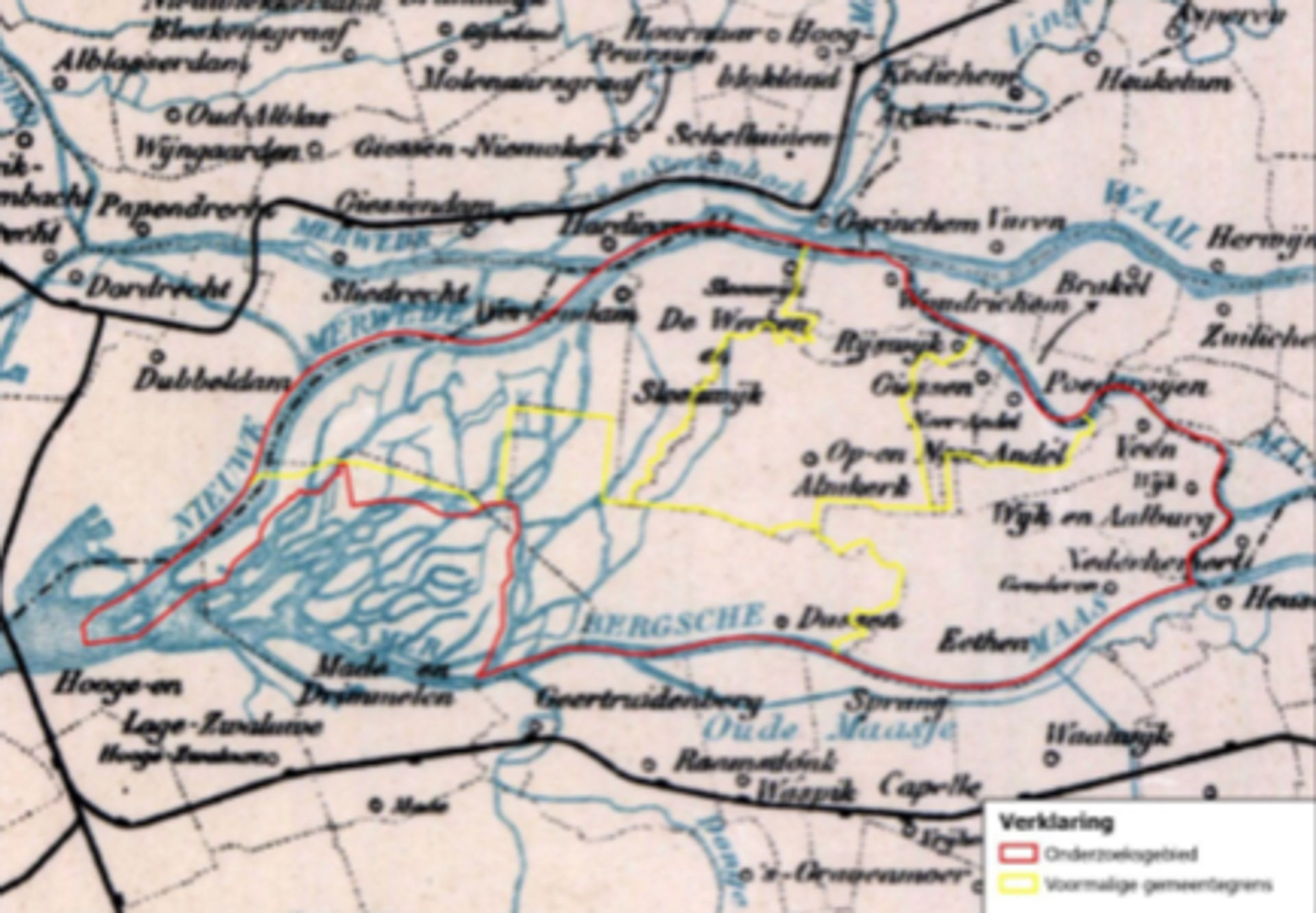
In addition, an accompanying report of no less than 341 pages was provided. This described the entire research process, which sources were consulted and which choices the research team made during the process. Such a first choice was the issue surrounding the territory of the municipality: the municipality of Altena has a considerable territory (226.64 km2!). This was therefore divided into five sub-areas; based on former municipal boundaries from during the war. The figure below is the national municipality map from 1943 and shows that division (the entire research area (red) and the sub-areas (yellow)). The division into sub-areas was necessary to maintain an overview of all war actions that were investigated during the historical research.
Historical context: The Land of Altena
Based on the scope of the five sub-areas, the Historical Preliminary Research department has conducted step-by-step research. Before we delve deeper into the details of the historical research, it is necessary to briefly explain the war context of Altena. The municipality emerged from the war badly damaged. With the German invasion in May 1940, several planes crashed in the Biesbosch, mine barriers were constructed in the Nieuwe Merwede and troop movements took place. During the occupation period, the air war continued to leave its mark on Altena and dozens of German and Allied aircraft crashed.
In addition, there have been several 'spontaneous' bombings in which an aircraft (trying to get away from an enemy aircraft) releases bomb ballast. This allowed the aircraft to gain more speed and perhaps escape from its attacker, the bombs often ending up in open fields and sometimes in built-up areas. However, Altena suffered most in the period after the Allied troops reached the Meuse at the end of 1944 and Altena remained occupied territory until the liberation on May 5, 1945. The entire southern edge of Altena, with village centers such as Dussen, Hank and Genderen, was in the protective field of the Allied artillery and was therefore completely destroyed. Finally, several targeted bombings have been carried out on infrastructure and military structures. This made it possible to state with certainty prior to the research that a lot of OO can still be expected in the soil of the municipality of Altena.
The second part of this triptych will be published next week, with the theme: How do we get our information?
- Nederlands
- English
- Deutsch
- Francais