
Airplane crashes, aerial bombardments and artillery bombardments: the municipality of Altena had to endure a lot during the Second World War. It is therefore not surprising that possible explosives (Explosive Remnants of War) have been left behind in the soil. The historical researchers at Den Ouden Bodac have mapped these out. Colleague Martijn van Bommel explains in this triptych how they tackled this. In this last part of the triptych: what are the next steps?
Dataverwerking: Geografisch datasysteem ArcGIS Pro
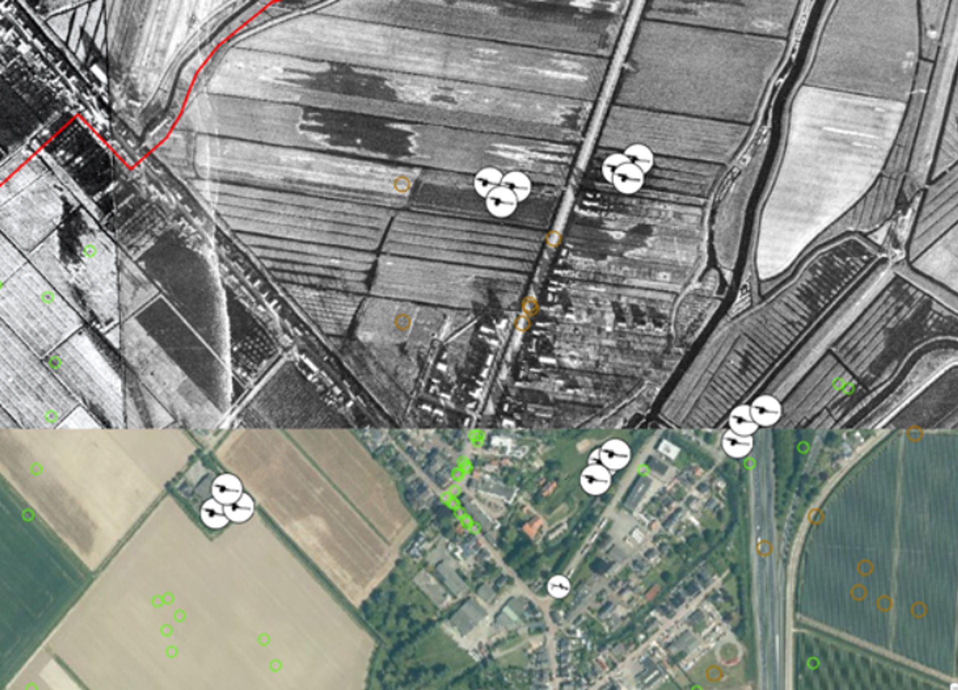
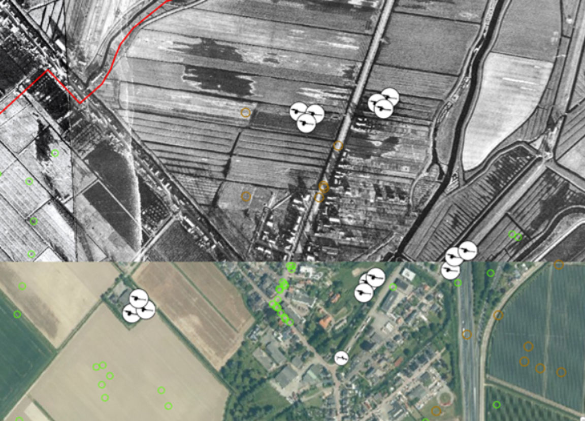
With the geographic data system ArcGIS Pro we can position all finds, indications, (historical) maps, aerial photographs, etc. at the correct location and correspond with each other. In the image below you can see, for example, how the following layers correspond with each other (from bottom layer to top layer): Current aerial photo, Historical aerial photos from 1944 showing craters and positions, a layer with drawn positions based on aerial photos and resistance intelligence and a layer with craters drawn based on Allied war diaries and aerial photographs.
The different layers have been projected on a larger scale to give an idea of several indications found in the area. This creates an image of approximately where the traces of the war can still be found in the ground today. Please note, this is only a brief import and processing of data into our system. Some other examples of data layers that can be easily positioned in ArcGIS Pro are ammunition finds from the EODD, post-war damage reports, mine laying reports and Fire Plans from allied artillery units. The more data, the stronger the suspicion of OO.
Green and brown circles are visible craters on historical aerial photographs. White circles with black icons are statements.
Uiteindelijk product voor de klant: OO-Risicokaart
The aforementioned layers of research (source research, data processing and data correspondence) have been carried out per sub-area in the municipality of Altena for each indication found. It was a painstaking task that took our team of four people more than a year to complete. Ultimately, the customer, the municipality of Altena, is most interested in the end result: the OO Risk Map; where is OO located in their municipality?
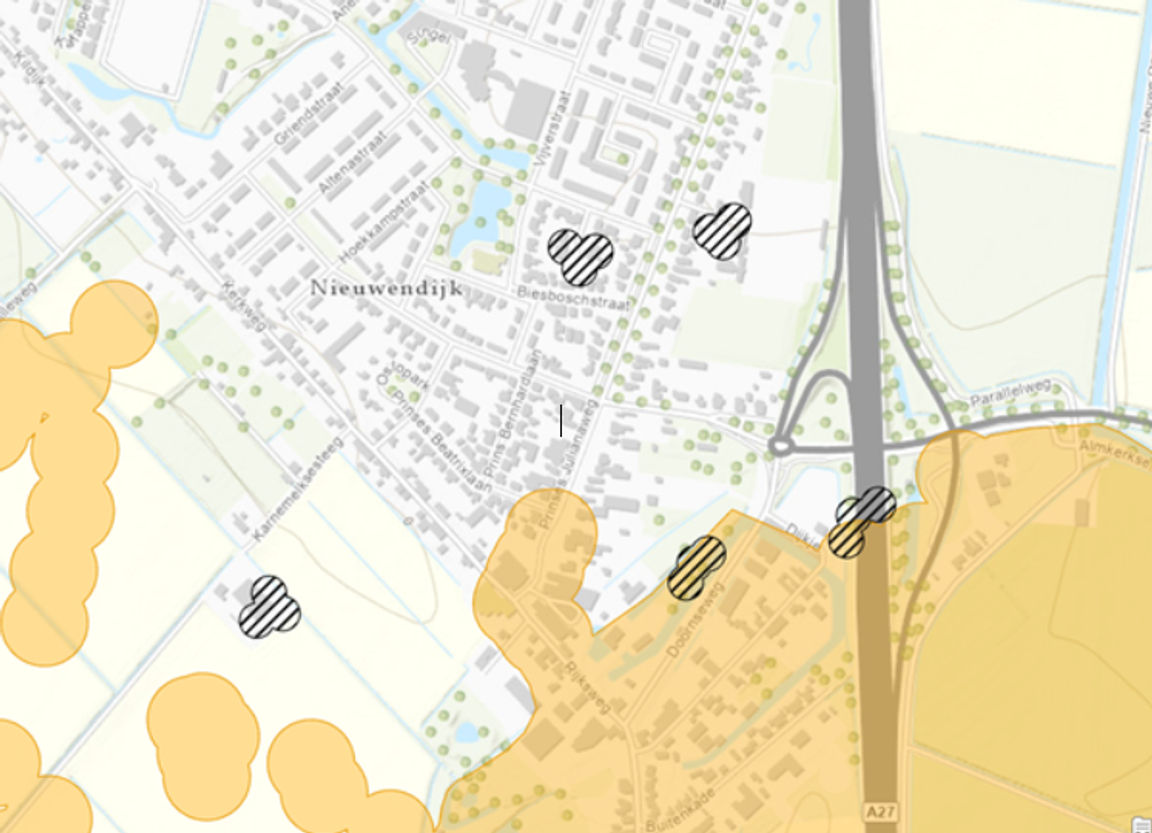
Ultimately, they can apply policy to this. The department works out the final horizontal demarcation (where 'horizontal' on the surface are OO?) on the basis of the CS-VROO: a certification scheme drawn up by VOMES, a foundation for professional groups that work with explosive substances or OO. With regard to the above-mentioned indications, the following section of the OO Risk Map will emerge, see the adjacent image.
Orange is faded artillery ammunition, black striped is dumped artillery ammunition.
Ultimately, the Historical Preliminary Research department decided that, based on regional, national and international source material, several areas around Nieuwendijk are suspected of possibly finding faded artillery ammunition and dumped artillery ammunition. The horizontal demarcation is based on practical figures from the EODD, our own investigation branch, and general data regarding artillery bombardments. It was decided not to perform a vertical delineation (to what depth are OO?) for this study. Since different guns were fired at Altena, it is impossible to show this exactly in terms of depth on the map. Finally, the municipality of Altena received a map, like the section above, for their entire territory. Complete with all expected main types of ammunition: Artillery ammunition, Infantry ammunition, Drop-off ammunition, Rocket ammunition and Aircraft wrecks.
Next steps for the municipality of Altena and Den Ouden Bodac
The municipality has yet to definitively adopt the zoning plan, but will include the map in its plan and environmental law. It was previously indicated that a vertical delineation was not carried out in this study, which requires further research. The Historical Preliminary Research department carries out this upon request for the municipality of Altena under the name Location-related Explosives Inventory (LEI). Advice flows from the LEI, such as detection advice, or an investigation after the conflict period, and the municipality takes this advice into account in the permit phase. In this way, Den Ouden Bodac continues to support the municipality with the explosives issue.
- Nederlands
- English
- Deutsch
- Francais